Thorsborne Trail
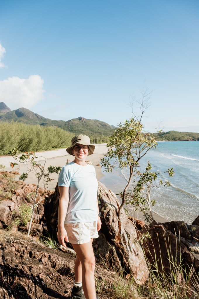
Hiking Hinchinbrook Island is raw, wild Queensland at its best—rainforest trails, remote beaches, and epic coastal views all in one place. It’s challenging, humid, and absolutely worth it. In this blog, I’ll share what to expect, the best highlights, and a few practical tips to help you plan an unforgettable hike.
Let’s check the facts.
Hike: Thorsborne Trail (Hinchinbrook Island NP)
Total distance: 32km (Depending on side routes)
Duration: 4 days/3 nights (some stretch it out to 5 days to allow a rest day at Zoe Falls)
Difficulty: Moderate-Hard (heat, humidity, soft sand and pack weight are the challenge)
Terrain: Soft sand, rainforest, creek crossings, swamp, rocky sections and coastal headlands
Camping: Designated campsites only (permits required)
Best time to go: Winter, North Queenslands dry season
It may not be the longest hike you do, but it will be one of the most rewarding.
How to get there.
First things first, before you book any travel you must organise your permits. Be quick to jump on your desired dates as there are limited spots per day and they book out fast.
To book a permit: Thorsborne Trail Pass
Now you have your permits booked, transfers to the island are next on the agenda. I travelled to Lucinda and used Absolute North Charters. John the skipper will meet you at the dock on the morning of your transfer, so I recommend arriving the day before and staying in some accommodation for the night, so you are well rested for an early transfer.
To book a transfer: Absolute North Charters
Let’s talk gear. Packing for the tropics, even in the ‘dry; season can still be very unpredictable. Please see the link for my pack list.
To see pack list: Pack List
Day to Day Itinerary
Day One – Ramsey Bay to Little Ramsey Bay
6 – 6.5km
2-4 hours (longer with Nina Peak / swim stops)
When you step off the boat you immediately know you’re in Tropical North Queensland — the mangroves, the humidity, and the unmistakable swarm of sandflies.
Handy tip: apply insect repellent before the boat transfer. It saves you frantically digging through your pack while the sandflies descend.
From the landing, you’ll follow a short floating jetty and the only section of boardwalk you’ll encounter on the entire trail, winding through dense mangroves before emerging onto a sandy clearing.
This is the moment it really hits you. It feels like stepping back in time — raw, prehistoric, almost otherworldly. Today’s walking is varied but gentle — stretches of sand underfoot, small creek crossings to navigate, and pockets of dense coastal vegetation offering brief shade from the tropical sun. The landscape feels ancient and untouched, and there’s a quiet rhythm to the walking as you settle into island time.
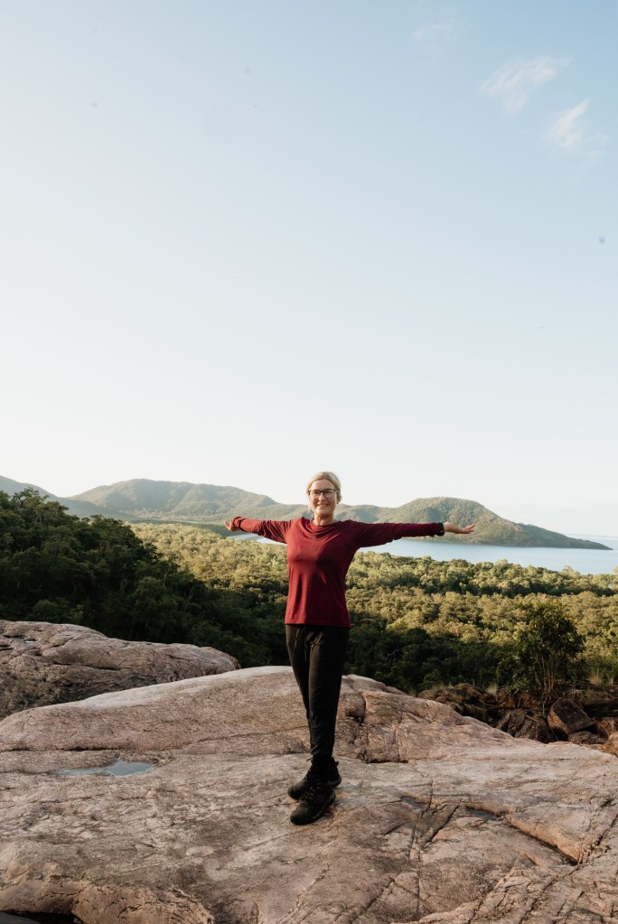
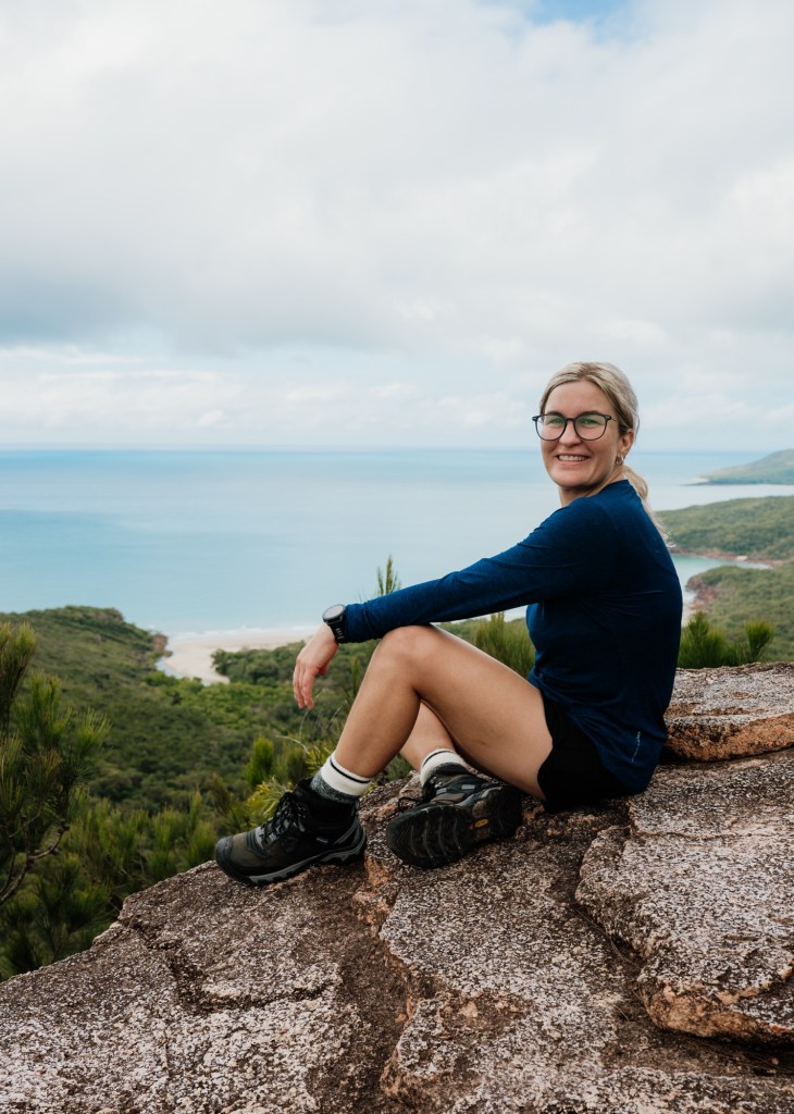
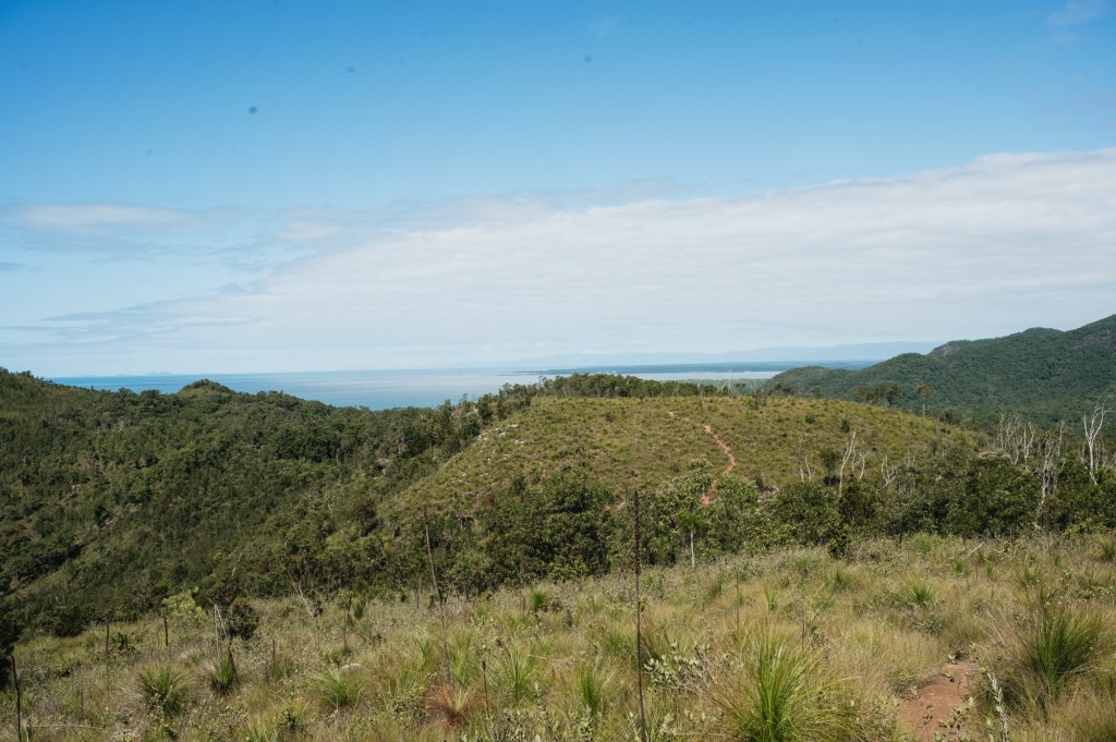
The first day is also the shortest and relatively easy, making it the perfect opportunity to take on a side trip up Nina Peak if you’re feeling strong. The turnoff is subtle but visible from the main trail. Leave your full packs at the base and take only a small daypack with water and essentials — you’ll be glad you did.
From here, the route quickly becomes less of a defined path and more of a faint goat track winding upward. The initial section is a moderate-to-hard incline that soon turns into a hands-on scramble. It’s important to note that this is not an official or maintained trail. Expect steep dirt slopes, loose rocks, and sections of thick vegetation that require careful navigation. In places, you’ll be pulling yourself upward rather than simply walking, but with steady footing and patience it’s entirely manageable for confident hikers.
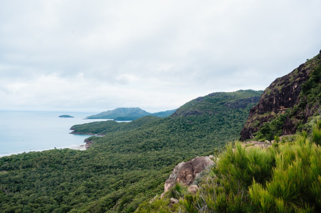
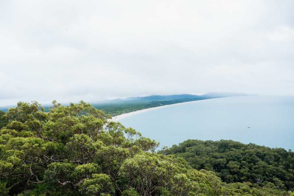
As you climb higher, the views begin to open — first glimpses of Nina Bay below, then sweeping coastal vistas that stretch far along the island. Reaching the top feels incredibly rewarding. From the summit, the scale of Hinchinbrook truly reveals itself: rugged mountains rising behind you, endless coastline ahead, and the Coral Sea beyond.
It’s the perfect place to pause. Brew a quick cuppa, unpack some lunch, and take a moment to absorb the surroundings. Few hikers make the effort to climb Nina Peak, which makes the experience feel even more special — quiet, remote, and entirely your own.
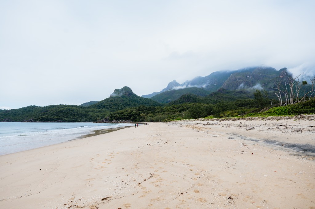
After returning to the trailhead, it’s only a short walk to your first overnight stop at Little Ramsay Bay. The designated camping area sits just off the beach, tucked behind coastal vegetation for shelter from the elements. Something to note about Little Ramsey Bay, when you first arrive you will be be greeted by a crystal clear pool with Mt Bowen as a remarkable back drop it looks so enticing for a swim after your humid climb up Nina Peak, but don’t forget this is crocodile country, and being so close to the ocean its strongly advised not to swim, there is a fresh water creek further inland from the main camping area for a freshen up.
If conditions allow, pitching your tent closer to the beach can offer a welcome breeze — often enough to help keep the sandflies at bay compared to campsites set further back. Even so, tropical-strength repellent and mosquito coils quickly become essential companions on this trail.
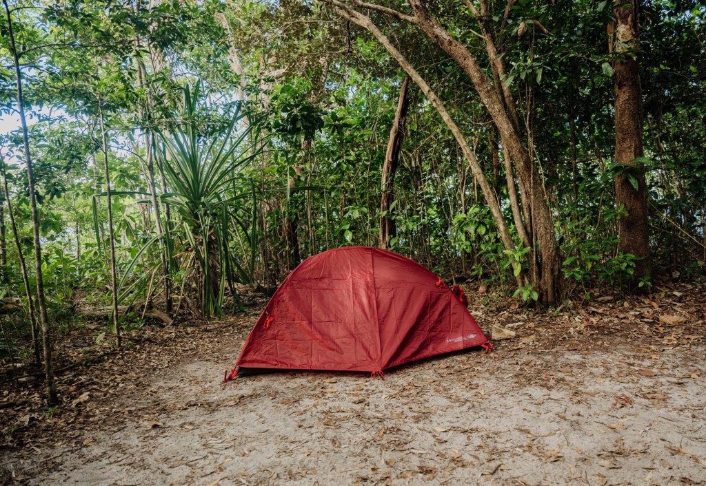
Facilities at Little Ramsay Bay are basic but practical. Each site has a private clearing, a timber platform and a pole with a hook to hang your pack high from hungry rodents. A composting toilet is located nearby, and a freshwater stream further inland provides a place to refill bottles and have a quick wash (treat all water before drinking).
An early start the next morning is well worth it. Sunrise over the bay is spectacular — soft light over the water, the sound of the ocean, and the island slowly waking around you. It’s a peaceful moment before setting off on one of the longer and more demanding days of the Thorsborne Trail.
Day Two – Little Ramsey Bay to Zoe Bay
10-11km
5-7 hours (longer with swim stops)
The second day of the Thorsborne Trail is, without argument, the most demanding. Headland rock hopping, short climbs through scrub, dense grasslands and swamp sections all build toward the reward at the end — Zoe Falls.
An early start is strongly recommended. Keep a close eye on the tides, as several creek crossings are tidal, and be prepared for muddy conditions through the lowlands if there has been recent rain.
You’ll leave Little Ramsay Bay and begin by traversing the rocky coastal headlands. Trail markers can be difficult to spot here, and you’ll notice multiple “goat tracks” where walkers have taken slightly different lines. The headlands are exposed and generally easy to navigate — choose the route that feels safest and most stable underfoot.
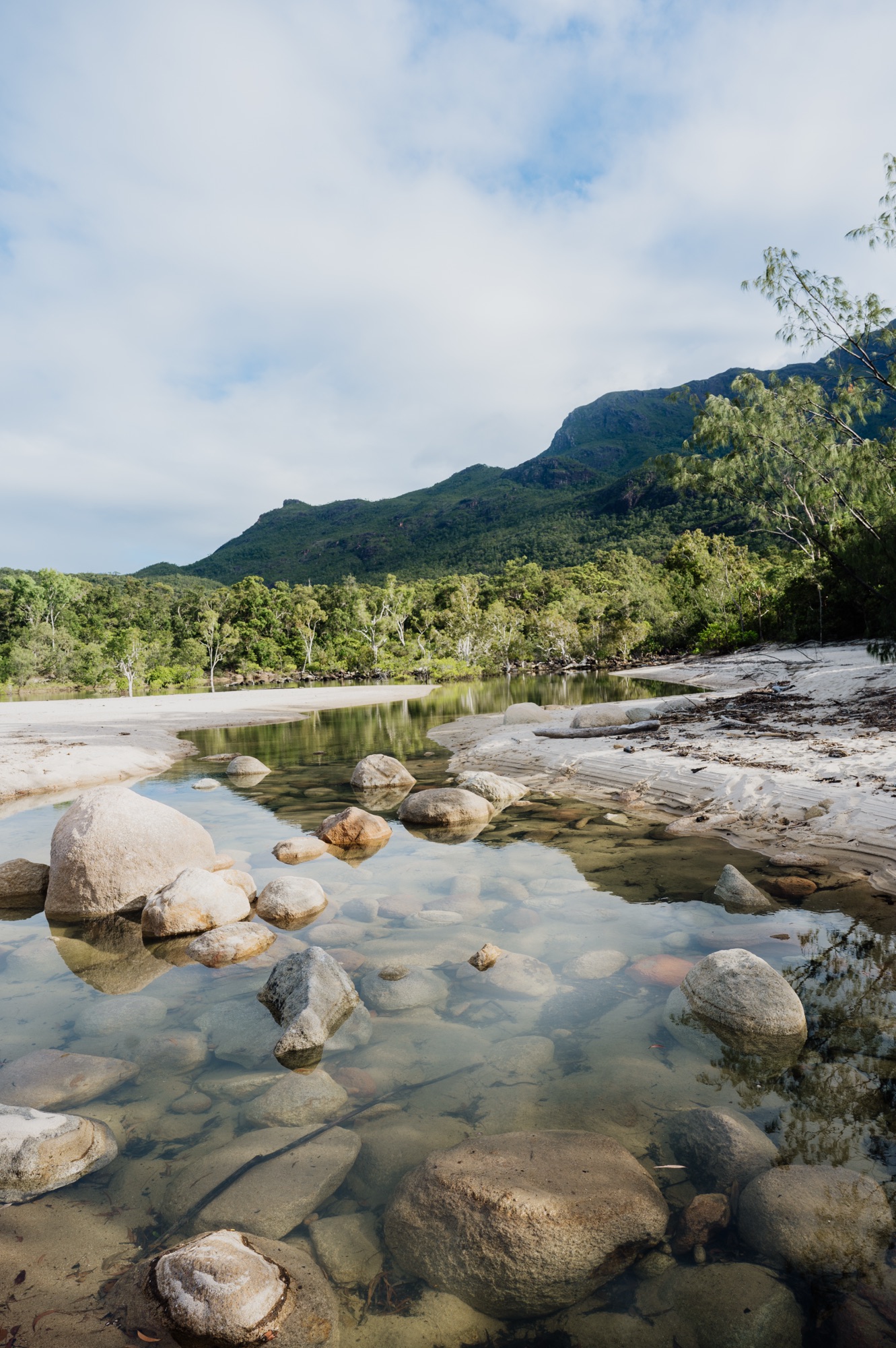
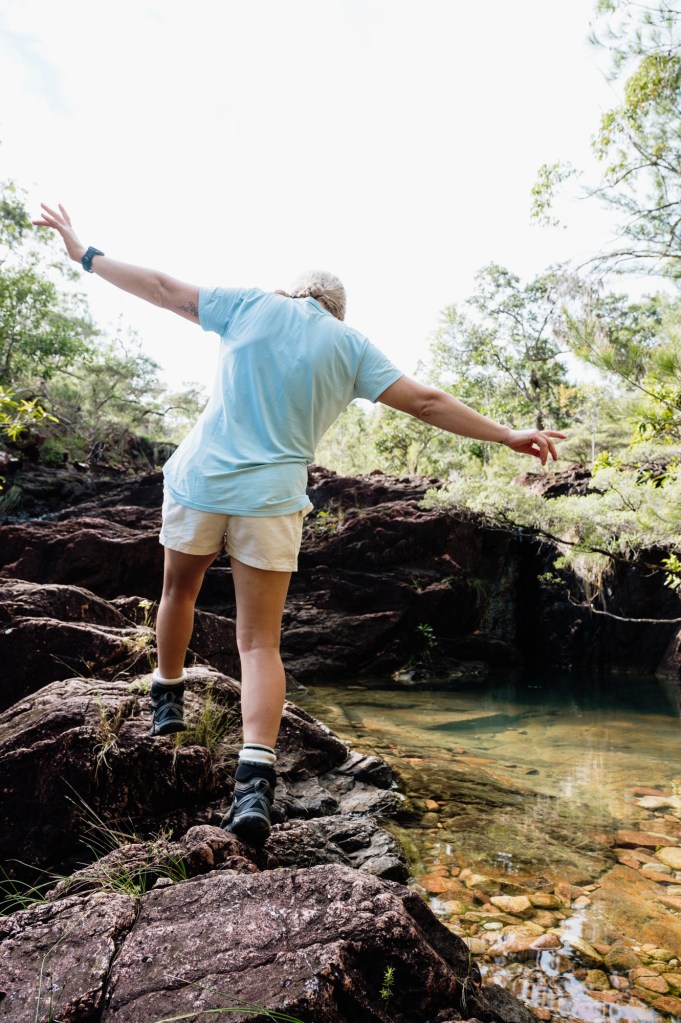
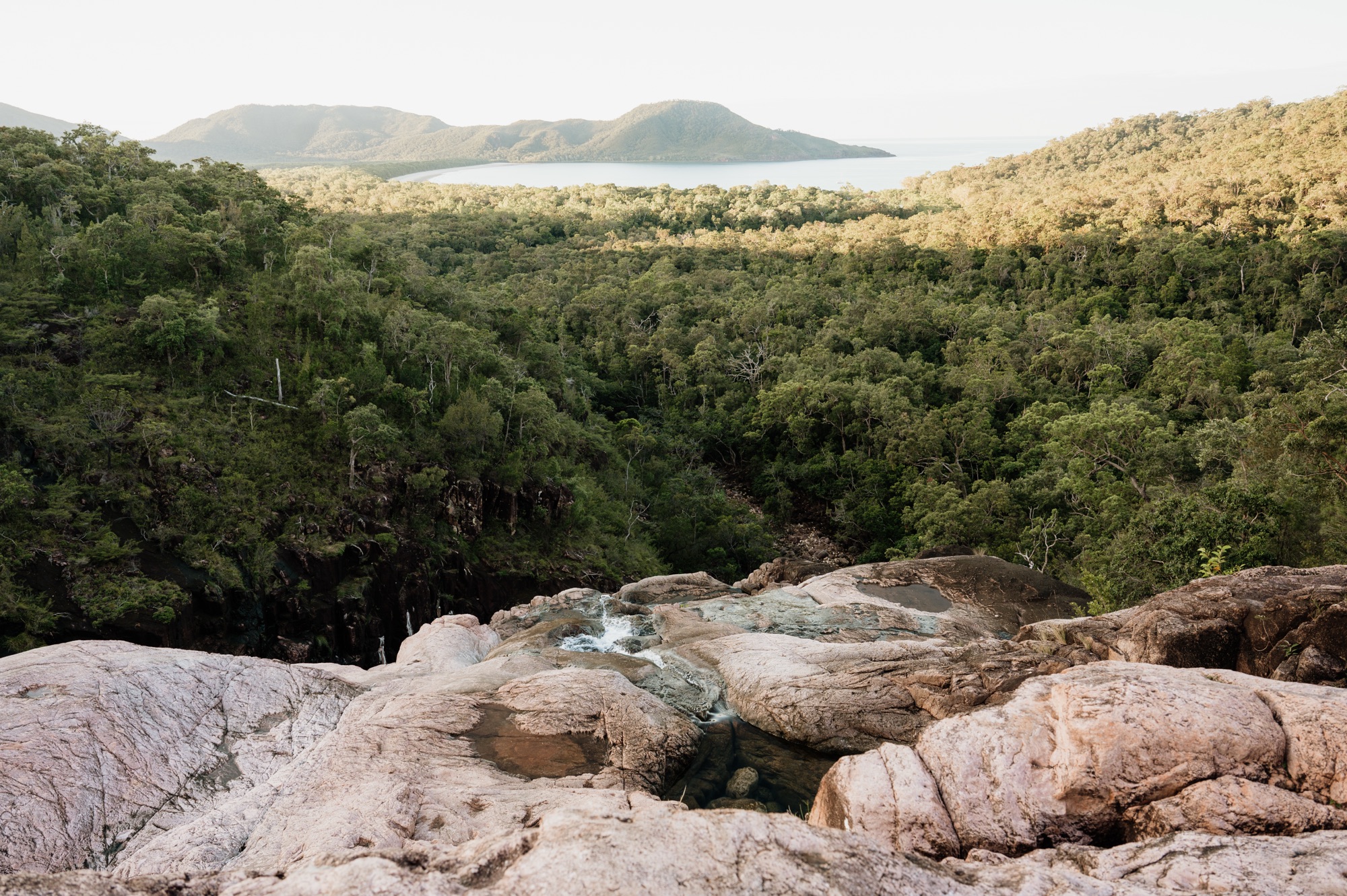
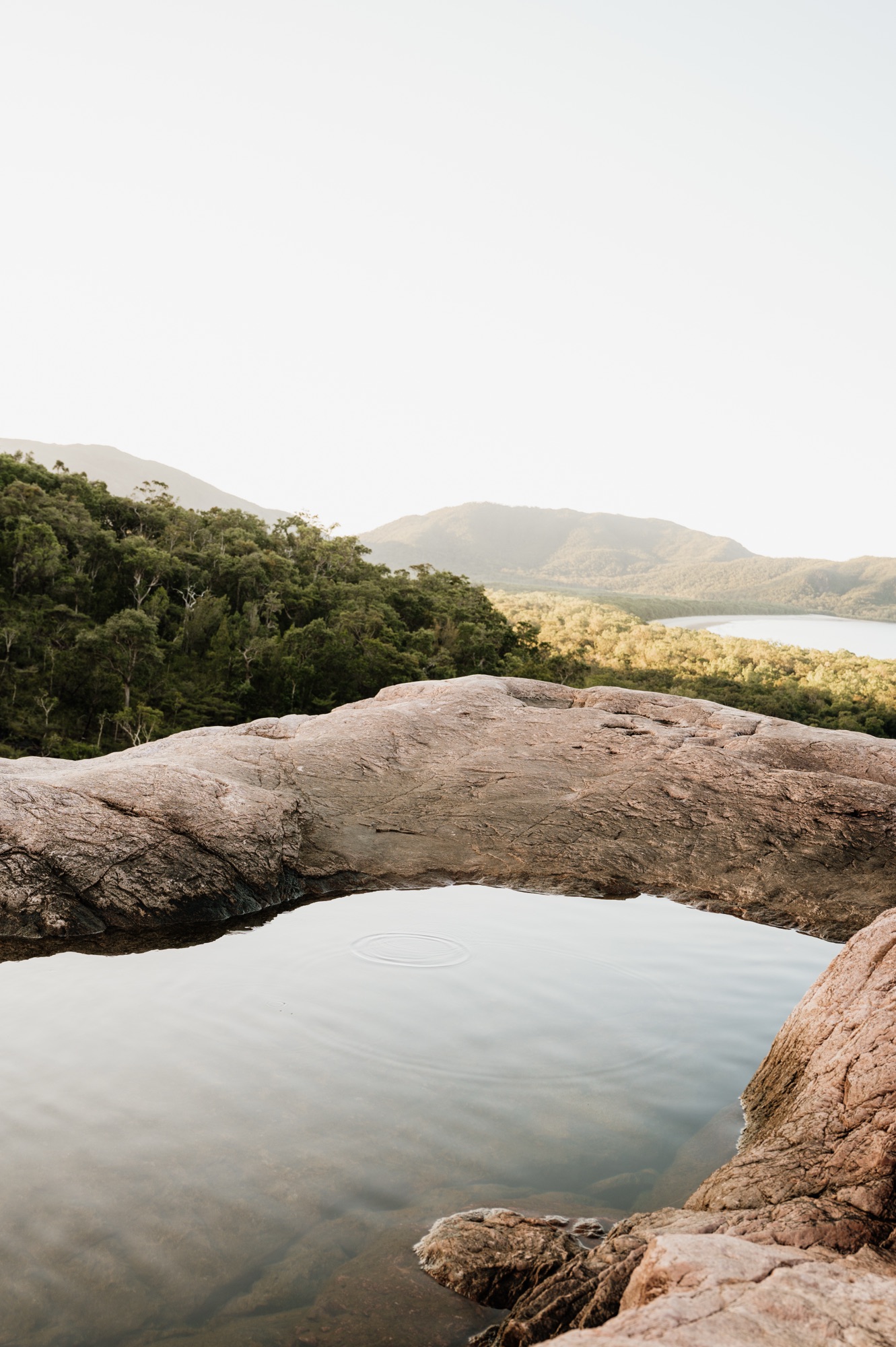
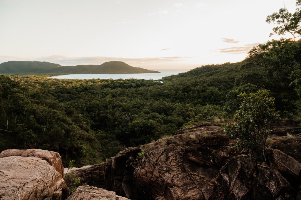
Approaching Bankisia Bay, the trail turns inland and begins to climb. Natural rock steps wind through scrub and open forest, offering a welcome break from the coast. Not far beyond — around 250 metres past the Bankisia Bay turn-off — you’ll find an ideal smoko stop beside a crystal-clear pool. It’s the perfect place to brew a cuppa, cool off, and reset before pushing on.
The track then leads toward North Zoe Creek. This crossing is tidal and clearly signed as crocodile habitat — not a place to linger or swim. Cross at the shallowest point and, if timed with low tide, it’s usually straightforward.
Next comes Fan Palm Swamp — for many, the “what am I doing here?” moment of the entire trail. Expect mud, sandflies, and slow progress through low-lying grasslands. After rain, sections can become a knee-deep slog. The track can be difficult to follow, so keep a constant eye on the orange markers.
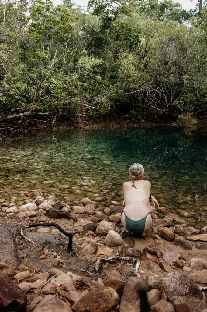
Emerging from the swamp, you’ll be dirty, tired, and ready for a wash. Blue Lagoon, a couple of kilometres further along, is the perfect place to rinse off, refill water, and stop for lunch before the final stretch.
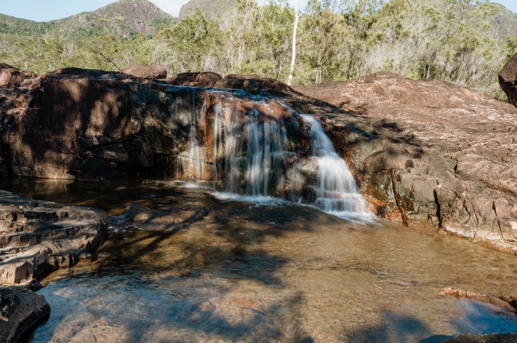
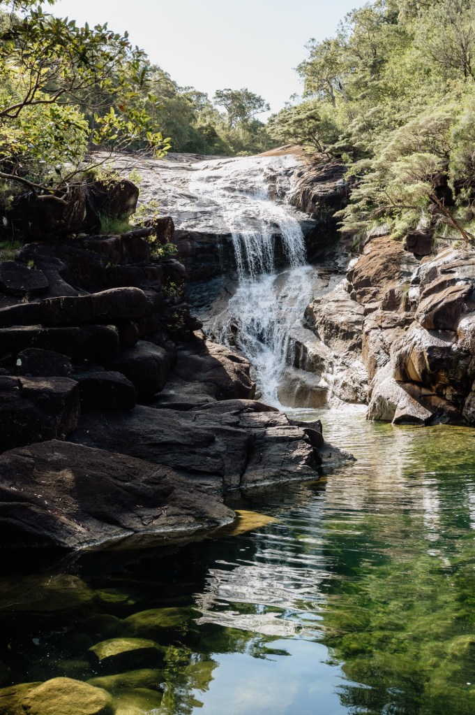
From here, the trail pushes on to Zoe Bay and the campground. Settle in, drop your pack and set up, before making time for the short but steep walk to Zoe Falls — the true highlight of the day and one of the best swimming spots on Hinchinbrook Island. Ammenities at Zoe Bay campground itself are basic, but expected. Tent sites are openings along a log boarded path through the forest. Each have a pack pole (very important here as possums are frequent visitors in the night), and a platform. I took some local advice and camped in the ‘Forest Campsite’ opposed to the beach sites, as the Bay itself is protected from the wind and sandflies are brutal along the beach front. Water collection is best from Zoe Falls, and toilets are at the far side of the campground.
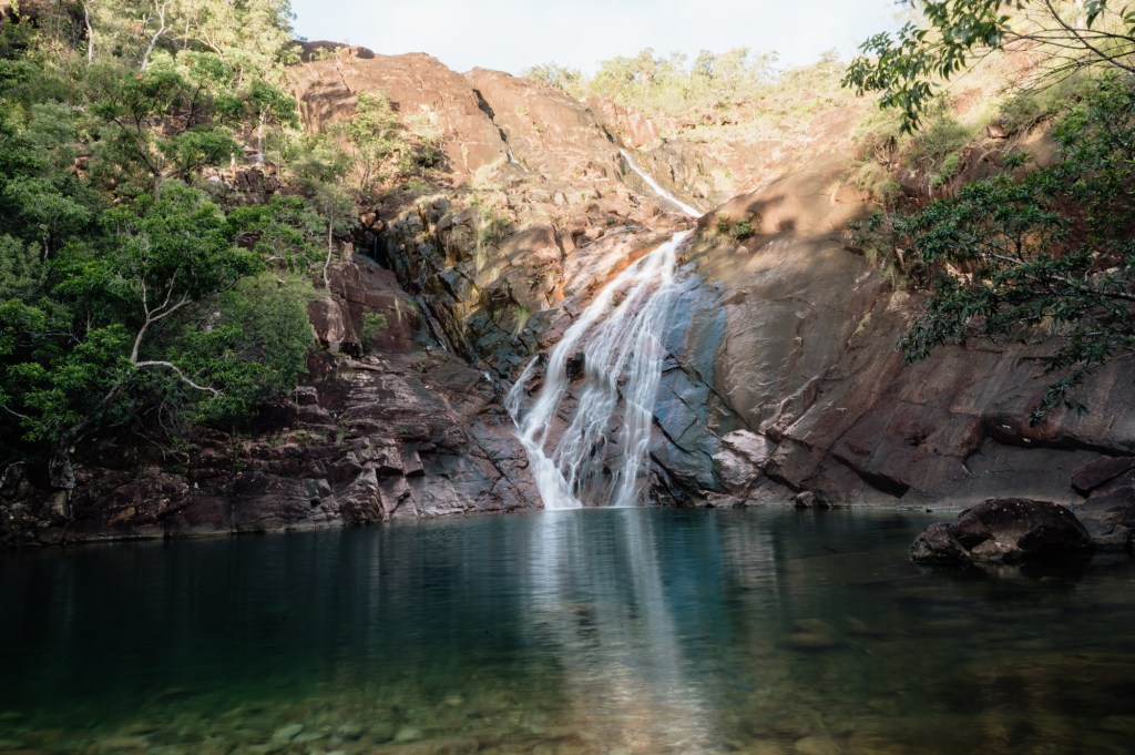
I highly recommend taking a head torch and making the climb up to the top of Zoe Falls on the afternoon you reach camp. This is the same section you’ll tackle at the start of day three, and doing it first without a full pack makes a huge difference.
It’s also one of the most rewarding side trips on the entire trail. Sunset and sunrise from the top are spectacular — quiet, expansive, and completely removed from the busier areas around the lower falls.
The climb itself is the most physically demanding short section on the track:
- creek crossing at the base
- steep natural rock “stairs”
- uneven footing
- a fixed rope climb near the top
Scoping it in daylight sets you up perfectly for the following morning. You’ll know the line to take, where the rope is, and how the terrain feels underfoot — especially helpful if you plan to head up before sunrise or in low light.
I climbed it three times during my trip and never regretted it. Each time felt different — sunset glow, early morning stillness, and the practical benefit of knowing exactly what to expect when starting day three.
Day Three – Little Ramsey Bay to Mulligan Falls
7-8km
4-6 hours (longer with swim stops)
Day three begins with one of the most physically demanding sections of the entire Thorsborne Trail — the climb above Zoe Falls. If you took the time to scope this the afternoon prior, you’ll be grateful for it now. With full packs, the ascent feels very different. I recommend an early start to the day to beat the heat.
You’ll start by crossing the creek at the base of the falls before tackling steep natural rock stairs that wind upward through dense rainforest. The footing is uneven and often damp, and the fixed rope section near the top requires patience and steady movement.

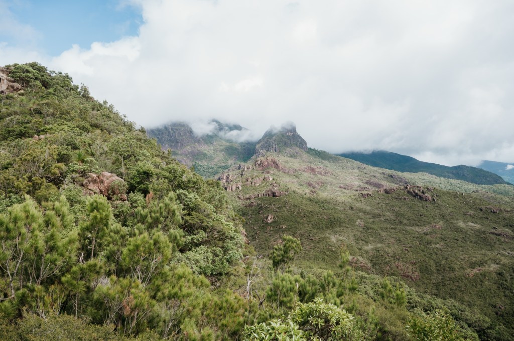
Once above the falls, the trail shifts away from the dramatic coastline and into the island’s interior. The environment becomes quieter, more enclosed, and deeply tropical. Expect shaded rainforest walking, rolling climbs and descents, tangled roots underfoot, and the constant hum of insects.
The terrain through this section is slower than it appears on a map. There are multiple creek crossings and muddy patches, especially after rain. Navigation is generally more straightforward than day two, but the track can still be slippery and uneven. Water is plentiful along this stretch, with creeks offering regular opportunities to refill and cool off.
By the time you arrive at Mulligan Falls campground, the pace of the trail softens. The camp sits within the rainforest, close to water and sheltered from wind. It feels more remote than the coastal camps, quieter and more enclosed, with fewer expansive views but a strong sense of isolation.
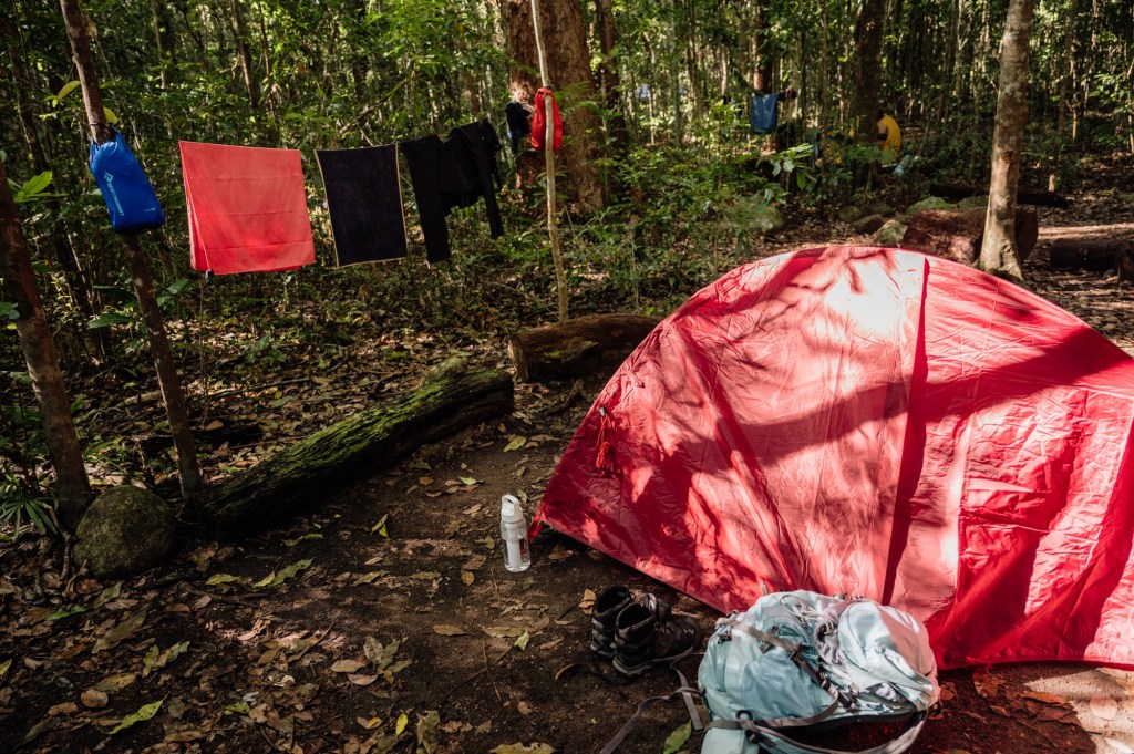
The camp was under construction when I took on the trail, and only about half of them had pack poles and platforms. I had to sleep with my pack in the tent on the third night as I wasn’t lucky enough to secure a site with a pack pole and had four legged visitors picking at my pack in the night. Compositing toilets are provided, though also under construction at the time of my visit, so hikers had use of the construction workers port-a-loo. Water collection is best from Mulligan Falls itself, and it’s the perfect spot for a dip to refresh as well.
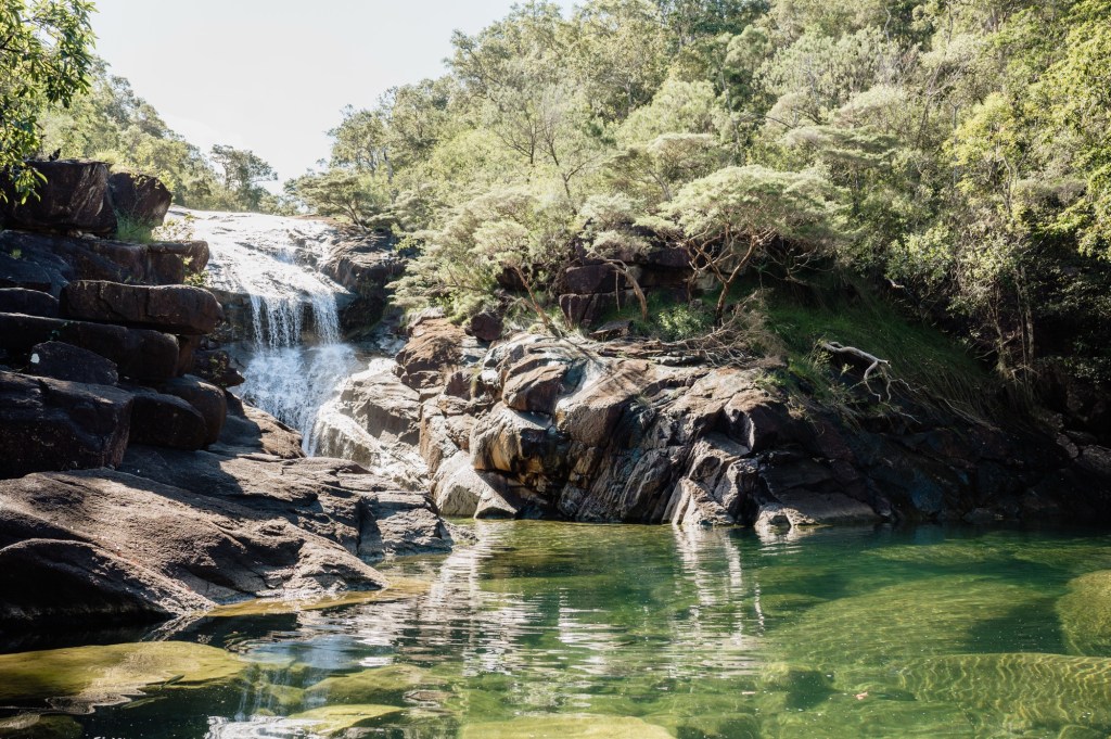
Many hikers find this is the first afternoon where the body finally relaxes into the rhythm of the trail. The hard navigation and exposure of day two are behind you, and while the terrain still demands respect, there’s space to slow down, recover, and take in the surroundings.
Spend the afternoon resting, exploring nearby creek lines, or simply sitting with the stillness of the forest.
Day Four – Mulligan Falls to George Point
7-8km
3- 5 hours (tides and pick up time dictate pace)
The final day on the Thorsborne Trail is shorter in distance, but it still demands attention. Hinchinbrook has a way of reminding you that the trail isn’t finished until you’re standing at the pickup point.
Leaving Mulligan Falls, the track continues through rainforest, following creek lines and weaving through dense vegetation. The terrain is varied — patches of soft earth, exposed roots, short climbs and descents — and while not as physically intense as previous days, fatigue in the legs can make even gentle sections feel slower than expected.
The trail gradually trends toward the coast, with the forest beginning to thin in places. You’ll cross several small creeks along the way, offering final chances to refill water or cool off before the exit.
Navigation is generally straightforward on this section, but it’s still important to watch the markers. Sections of the track can blend into the surrounding bush, especially in overgrown areas.
As you draw closer to George Point, the air shifts — more movement, more light, and the subtle sense of returning to the edge of the island. The final stretch opens out toward the shoreline, and before long you’ll arrive at the pickup point. I organised to be picked up just as the forest opens up to the shoreline. However, navigating the remainder of the way is easy – just follow the beach!
The transfer back is much faster than the transfer out to Hinchinbrook as you walk South towards Cardwell, this is usually a welcomed relief as a hot shower and a well cooked lunch will be top priority when arriving back to the mainland.
